
Trace a Liberty Township Street
A sound Liberty Township street directory search follows the property rather than assuming an address is a person list. Begin with the Butler County Auditor, identify the parcel and legal description, and use the GIS map to place it among the surrounding lots. Then use the Recorder to check recorded transfers. A voter record or a dated directory can corroborate a particular name, but neither should be stretched beyond what it says. Record the search date, property address, PIN, and legal description before moving to another source.
- Enter the street number and street name in the Auditor's address search, without a suffix.
- Save the matching PIN, situs address, current owner string, subdivision or lot, and legal description.
- Open the GIS Viewer, use Feature Info, and confirm the map parcel matches the same address and PIN.
- Use Recorder Cloud Search with the owner, legal description, prior sale date, or document information.
- For an individual check, use the official voter tool or a dated historical directory and compare the date and address.
This workflow separates a recorded property relationship from a current-person claim. The address remains the continuity point even if a postal label or a recorded party changes.
Liberty Township Address Search Fields
Butler County Auditor Property Search supplies the practical entry form for a street directory search. The address mode has Street Number and Street Name fields, and the form specifically says not to add a street suffix. The owner form uses LastName FirstName without a comma. Partial text and a * wildcard are supported. Parcel ID accepts a full or partial PIN; most ordinary parcel PINs are 14 characters, although some other property classes use different lengths.
| Field or mode | Input | Street-directory use |
|---|---|---|
| Street Number | Optional text | Match the numbered address with Street Name. |
| Street Name | Optional text, no suffix | Use * where a partial form is necessary. |
| Owner(s) | LastName FirstName | Find a parcel after a name is already known. |
| Parcel ID | Full or partial PIN | Open a known property directly. |
| Advanced / Map / Sales | Mode choice | Combine street, legal, neighborhood, sale, and property criteria. No ZIP filter was observed. |
Results can include property facts, sales, values, exemptions, a situs address, and a separate owner mailing field. Do not substitute the mailing field for a current residential address. It can be a notice contact, post-office box, organization, or another property.
Liberty Township Parcel Map Context
The Butler County GIS Viewer adds the map context that a text search lacks. Use address search, then Feature Info or a parcel click to confirm the PIN, legal description, and map location. Available layers include parcels, roads, municipal and Township boundaries, FEMA areas, imagery, and related feature tools. Its Near Me function can help inspect nearby features, but it does not turn the map into a street-by-street roster.
For a disputed boundary, altered number, lot split, new address, plat, or survey issue, contact the Butler County Engineer. The Engineer assigns new addresses and keeps tax maps, subdivision plats, surveys, and aerials. The public GIS display supports discovery, while the Engineer's map and survey records are the authority to ask about a property-boundary question.
- Parcel
- A mapped property unit identified by a PIN in county tax and map records.
- Situs address
- The physical location assigned to a parcel, separate from a mailing contact field.
- Plat
- A recorded map that lays out lots, blocks, or a subdivision.
- Legal description
- The recorded land description that links deeds and plats even when a street label changes.
- Criss-cross directory
- A historic directory arranged by street address rather than surname.
Owner Fields on Liberty Township Streets
A parcel-card result is useful because its fields are not all the same thing. The county's backing service has owner and mailing-name fields, site-address components and LOCATION, legal-description fields, parcel geometry, value and sale fields, tax flags, and neighborhood or school-district information. A property owner may have a connection to the parcel, but that record does not identify everyone linked to the address. Treat each field according to its label.
When an address returns several candidates, compare the street number, PIN, lot or subdivision, and legal description before opening any deed. Do not merge a similar street name, a unit address, and a mailing address. The street directory method becomes reliable only when each link belongs to the same parcel.
Deeds Along a Liberty Township Street
Recorder Cloud Search follows a property into its recorded-document history. Quick Search accepts a grantor, grantee, subdivision, document type, or document number, plus a date range. Advanced fields include party names, document types and numbers, Book and Page, city, subdivision, township, condominium unit, and recorded date range. The Index Only and Index & Full Text OCR choices serve different purposes. An OCR hit can be a lead, but the instrument and legal description should settle the match.
Open the most recent acquisition deed and note the grantor, grantee, recording date, document number or book and page, legal description, and prior-instrument reference. To move backward, search the seller as a grantee to find that party's acquisition. Searching that person only as grantor finds the later sale, not the earlier purchase. This sequence is the property history behind a Liberty Township street address.
Liberty Township Zoning by Address
The Township's iWorQ zoning-certificate portal is a separate address record layer. It can search Parcel Address, Certificate Number, or Applicant Name. Results include date, parcel address, certificate number, permit type, applicant name, status, inspection request, and a view route. These fields can date a project or identify an application relationship at a place. They do not identify every person connected to that address.
The Liberty Township iWorQ certificate search shows the address-and-application record route.
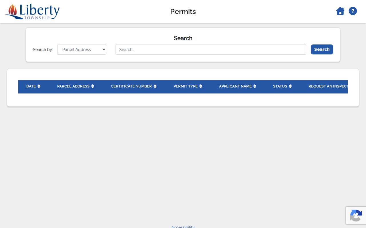
Use the certificate date and project fields as context for a parcel history, then confirm the property link through the county records.
Planning and Zoning can also route a request for zoning certificates, site plans, maps, complaints, and inspections. The Planning counter is a useful fallback when a portal result needs context, while County building records may be a distinct channel after the Township stage. A project history is most useful alongside the parcel and recorded-document trail.
Liberty Township Street Record Sources
Several records are keyed by address, but each has a different scope. This coverage table keeps the Liberty Township street directory focused on what the source actually shows and where a web result can be checked at the counter.
| Address record | Custodian | What it shows | Online and fallback route |
|---|---|---|---|
| Property and tax record | Butler County Auditor | Owner string, situs and mailing fields, PIN, legal description, sales and values | Address, owner, PIN, advanced, map, and sales modes; counter |
| GIS parcel viewer | Auditor / Engineer data | Parcel geometry, roads, adjacent lots, imagery and map layers | Viewer and Feature Info; Engineer tax-map and survey route |
| Recorded deeds and plats | Butler County Recorder | Parties, document and recording dates, legal descriptions, plats | Cloud Search; historic geographic, alphabetical, and book paths; counter |
| Zoning certificate | Liberty Township Planning & Zoning | Application, project, parcel, date and status | iWorQ table or a defined records request |
| Voter information | Ohio / Butler Board of Elections | Statutorily public registration information for an individual | Individual lookup, eligible public-file request, Board contact |
The PIN and legal description connect these sources more reliably than a street name alone. For older household entries and the collection years themselves, use the Liberty Township city directories collection rather than treating one modern parcel as a complete history.
ZIP Labels and Liberty Township Streets
ZIP codes can help present mail correctly, but they are not a substitute for an address search. Liberty Township uses five postal areas and no dedicated Township ZIP. The Auditor has no observed ZIP criterion. A 45011, 45044, 45069, 45036, or 45050 result may use a different postal locality while the parcel remains within the Township. USPS can standardize a known mailing address, then the Auditor and GIS tools can identify the property.
The county's parcel fields distinguish situs, mailing address, and legal description. A historical property trail needs the legal description and old locality label as well as the ZIP. The detailed ZIP geography, including the Maud-Hughes rail split and small outlying areas, belongs on the Liberty Township ZIP Directory.
Historic Liberty Township Street Listings
For a past address, MidPointe's digitized Middletown directories and Butler County Historical Society collections provide a dated street-address layer. The 1995 R. L. Polk object has Alphabetical, Business, Numerical Telephone, and Street Address sections. Its street section can be used as a historical criss-cross search, then checked against the alphabetical section and nearby years. The collection is useful for a nearby postal area, not proof of a complete Liberty Township run.
Butler County Historical Society holds incomplete Hamilton and Middletown directories from 1858 through 2017, plus county and rural directories. Ask staff which volume fits the road, subdivision, locality, and period. A road might be filed under a historic settlement, rural route, Hamilton, Middletown, or West Chester. The historic source's geography is part of the evidence.
Older Liberty Township Address Records
Recorder Cloud Search states formal online document coverage from 1987 forward, but older property work does not end there. The Recorder supplies geographic, alphabetical, historical-book, Red Book, and annexation paths. Selected Red Book material covers 1803 through 1876 and 1978 through 1987, while the geographic and historical-book routes are useful when a modern street address fails. Bring the legal description, Township, subdivision, lot, or section information to the counter rather than relying on a present-day street label.
The Butler County Records Center is a key fallback for early property context. Its 1820 through 1923 tax-duplicate volumes include real and personal assessments, are not indexed, and can have fragile-material limits. A request needs the Township, date range, and property or owner clue. The Center publishes its request directions and fee rules, with the first five pages free, email free when possible, and certification at $2 per record. This is an address-history path, not a general person search.
Limits of a Liberty Township Street Directory
An address-keyed record can document a parcel, ownership party, project application, recorded transaction, or a statutorily public voter result. It cannot prove every person tied to an address. Utility customer lists and DMV personal data are not public street-record sources. Ohio's Safe at Home and protected-voter rules also require custodians to withhold qualifying address information. Do not infer a protected address from other fragments.
Ohio Public Records Act requests should go to the office holding an identifiable existing record. A records request does not require a custodian to create a broad street compilation. Where a portal stops, ask for a defined record or inspection appointment, or consult historic books, the Records Center, or local-history collections.
Lawful use. Use Liberty Township street records for personal, family-history, estate, consumer-safety, or civic research. Never use an address or record trail to stalk, harass, intimidate, or harm another person.