
Liberty Township Neighbors by Block
Public records can outline the land around a Liberty Township address, but each record has a different job. The Butler County Auditor and GIS viewer begin with the physical parcel. The Recorder adds deeds, plats, and legal descriptions. Township zoning records can date an application or project. Official voter channels have tightly defined uses and fields. Association material is a way to reach an organization, not evidence of who occupies every house. Treat the result as a careful block picture, not as a public household roll.
| Block source | What it can show nearby | Access and limit |
|---|---|---|
| Butler GIS parcels and buffer | Parcel geography, shared boundaries, roads, and adjoining lots | Public map; ask the County Engineer about survey or tax-map authority. |
| Auditor property record | Owner string, situs and mailing fields, values, sales, and tax flags | Review each parcel separately; it is not a complete occupant list. |
| Butler County Recorder | Deeds, plats, legal descriptions, and transaction parties | Use Cloud Search, historical index routes, or the Recorder counter. |
| Township zoning certificates | Project, application, parcel, certificate, and status details | iWorQ and a records request show application roles, not occupancy. |
| Board of Elections records | Individual voter verification or a defined statutory public file | Protected fields and voters stay out; no street-roster control was observed. |
| HOA Directory and local history sources | Association contacts or dated community context | Neither is a current member or block household directory. |
A property owner can have a different mailing address, so that contact field is not proof of residence. The map’s site address identifies the property, while a legal description helps match the parcel to a deed or plat. That distinction prevents a Liberty Township neighbor search from turning a tax notice field into a claim about a person.
Liberty Township Neighbor Parcel Method
Use the Butler County Auditor address search to find the target property, then open the Butler County Auditor GIS Viewer. Address search, Feature Info, parcel boundaries, roads, imagery, and Near Me give the needed map context. Record the target PIN and legal description first. A parcel is a defined piece of land, and a PIN is the number used to identify it in the county system.
- Enter the known address and confirm the site address, PIN, and parcel outline.
- Zoom until the touching parcel boundaries are visible, then click each parcel with a shared boundary.
- Open the Auditor record for every adjoining PIN and keep its owner string, situs address, and legal description separate from its mailing fields.
- Use the Butler County Recorder Cloud Search to inspect the deed or plat tied to that legal description when transaction context matters.
- Keep a nearby parcel found by a radius separate from a physically adjoining parcel. A map buffer can be useful, but it does not make every result next door.
The advanced map search includes distance and unit choices, center-point or polygon selection, and a “Buffer using Parcels” option. It can support a wider Liberty Township block review, yet the shared lines on the parcel map are the sounder test for immediate neighbors. For a whole named road rather than one block, use the Liberty Township by-street records workflow.
Note: Parcel mapping helps locate property relationships, but the County Engineer remains the verified source for a disputed address, plat, survey, or boundary question.
Liberty Township Neighbor Parcel Fields
The public parcel service separates several facts that should not be blended together. It includes OWNER and mailing-name fields, PIN and prior-PIN identifiers, parcel geometry, legal-description fields, neighborhood and school-district information, and site-address components. It may also show acreage, land use, construction facts, sales, values, and exemption flags. Some of those details help distinguish two adjacent lots, but none identifies every Liberty Township neighbor living in a home.
- Site or situs address
- The physical property location carried in the parcel and assessment records.
- Mailing address
- An owner or taxpayer contact destination that can be elsewhere, an organization, or a post-office box.
- Legal description
- The recorded lot, subdivision, or land description that connects the parcel with deeds and plats.
- Parcel polygon
- The map shape used to inspect adjacency. It is useful for discovery, not a survey or legal tax-map substitute.
Start a deed search with the legal description or a known party name when an address is new, has changed, or falls in a subdivision. The Recorder’s formal online documents run from 1987 forward; older work may need its geographic, alphabetical, historical-book, or Red Book paths. A Recorder clerk or the County Records Center is the fallback when an online result is not enough.
Voter Checks for Liberty Township Neighbors
Ohio’s voter tools are for defined election records, not an open-ended neighbor list. Ohio My Voter Information takes a first name, last name, and county, then can narrow by street after a search. Butler County’s voter-record search asks for first name, last name, and house number. The Board’s polling form answers a precinct and location question, rather than producing a street roster.
Ohio Revised Code 3503.153 describes online voter-registration fields such as name, birth date, current residence address, precinct, registration date, voting history, and last activity date, subject to timing rules. Voting history records elections in which an elector participated. It does not reveal ballot selections. ORC 3503.13 protects Social Security numbers, driver or state identification numbers, phone and email fields, protected-voter information, and other restricted data.
The Butler County Election Vault has Township and smaller-area public-file categories, but a dated extract must not be republished as a block roster or treated as proof that every listed person lives there today. Ask the Board of Elections for guidance on a defined record or a correction. A missing or suppressed result does not prove that a Liberty Township neighbor is absent from an address.
Liberty Township HOA Neighbor Contacts
The Liberty Township HOA Directory is a useful community layer when a neighborhood name appears on a plat, permit, or map. It provides association contacts supplied by the associations. It is not a member list, household directory, or proof that a person lives in a subdivision. Township material also says it does not enforce private HOA rules, so a private covenant question belongs with the association or an appropriate advisor.
Several association names in the directory can help match a mapped subdivision to an organizational contact route.
| Association examples | Appropriate use |
|---|---|
| Allen Estates, Aspen Trails, Hawthorne Hills, Carriage Hill | Match a community name to an association contact, not to resident names. |
| Cherokee Estates, Creekside Meadows, Dutchland Woods, Emerald Hills | Ask the association about a community matter through its listed contact route. |
| Four Bridges, Hughes Woods, Providence, Vista Verde, Welbourne Manor | Use the directory as an organization reference and confirm details directly. |
The official HOA Directory source is shown below as an association-contact reference.
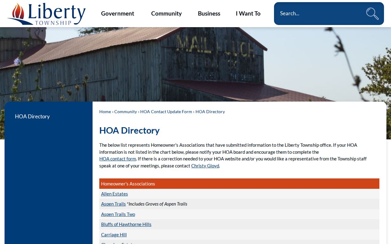
Association information can change, so use the Township’s update route or the listed association contact to confirm a current community connection. The image does not identify Liberty Township neighbors or provide a household list.
Compare Liberty Township Neighbor Sources
A careful Liberty Township neighbor inquiry stays close to sources that disclose their purpose and limits. Official property, deed, voter, and association sources are each narrow by design. Commercial neighbor-finder categories may combine data from different dates and systems, but a combined display does not cure stale information or show how a claim was verified. Compare the source category before acting on any result.
| Official source category | Commercial neighbor-tool category | Best practice |
|---|---|---|
| Parcel, deed, election, or association record with a named custodian | Compiled profiles and address associations from mixed sources | Check the original custodian and the date before relying on a name or address. |
| Defines fields, access rules, and a request channel | May not explain each source, update date, or suppression rule | Do not treat an aggregate result as proof of residency or ownership. |
| Limited to the record’s statutory or administrative purpose | May encourage broad name searches beyond the record purpose | Keep the search tied to a real property or civic question and respect privacy. |
Liberty Township Block Change Records
Property changes can explain why a block looks different without naming the people who live there. The Township iWorQ portal searches by Parcel Address, Certificate Number, or Applicant Name. Its observed results include date, parcel address, certificate number, permit type, applicant, status, inspection request, and a view control. A deck, pool, addition, fence, lot split, or new-construction certificate is evidence of an application or project relationship.
Planning and Zoning keeps these address-keyed materials and can route a defined records request. A builder, owner, or agent may appear as the applicant, and a status does not establish who lives at the address. For an older tract or a boundary question, the County Engineer keeps tax and subdivision plats, surveys, and aerials. Liberty Township’s land history also includes older settlement names such as Bethany, Princeton, Huntsville, Hughes, and Kyles, which can help locate historic material without becoming proof of a current household.
Neighbor Privacy in Liberty Township
Many facts remain private on a block. Parcel records do not list every occupant, every household member, utility customers, postal-delivery records, minors, or DMV customer information. Safe at Home participants and protected voter records have specific protections. Ohio has no verified enacted general data-broker deletion or universal-opt-out law in the research, so a correction or redaction request must go to the office that keeps the exact record.
For an online public record, ORC 149.45 requires Social Security-number redaction and provides a limited written identifier-redaction process for qualifying records. It does not erase historic land records or create a universal removal right. Never try to reconstruct an address that an official source has withheld.
Lawful use. Use Liberty Township neighbor records for a genuine property, community, family-history, or safety question. Stalking, harassment, intimidation, and attempts to expose protected information can violate Ohio law.
Note: When a record is wrong or needs redaction, contact the Butler County or Township custodian rather than asking an unrelated service to alter it.