
Liberty Township Previous Residents by Era
A house-history search changes source as it moves backward. Recent transfers begin with the parcel and Recorder record. Earlier research may need alphabetic or geographic books, assessment volumes, plats, nearby directory collections, or a released federal census. The era table is a starting map for one address. It does not mean that every source covers every Liberty Township road, household, or year.
| Source | Years it covers | Where held | Address-trail value |
|---|---|---|---|
| Recorder formal document collection | 1987 to present, stated | Butler Recorder Cloud Search | Recent recorded transfers, with some older scanned material possible through full text. |
| Recorder alphabetic books | 1803 to 1876 and 1978 to 1987, selected | Recorder historical search paths | Grantor and grantee recovery where the online era thins. |
| County tax duplicates | 1820 to 1923 volumes | Butler County Records Center | Unindexed real and personal property assessments. |
| BCHS owner-name plats | 1836, 1875, 1895, 1910, 1914, 1930 | Butler County Historical Society | Landowner names and historic property geography. |
| Directories and census | Directories 1858 to 2017 incomplete; census released through 1950 | BCHS, MidPointe, Lane, and federal research paths | Dated household and address leads that need corroboration. |
For a newer home, lead with the Recorder and Auditor. For a tract that predates a modern house number, lead with the legal description, plat, township, and tax-duplicate period. Keep the search date beside each online result because assessment and recording data can change. Note: A recorded buyer has a property relationship, not automatic proof of occupancy.
Liberty Township Past Residents and Parcels
Use the Butler County Auditor Property Search to establish the present parcel before treating a street address as continuous over time. Search by exact street number and street name, with no suffix, or use the owner, PIN, map, or advanced modes. Write down the PIN, current owner string, situs address, lot or subdivision, sale date, and legal description. The legal description is the best continuity anchor when a road name, postal label, or rural route changes.
Auditor results can show a mailing name and address as well as the situs. The mailing field is a contact or notice field. It can refer to an agent, post-office box, organization, or another residence. Compare candidates carefully when a number, unit, or similarly named road creates more than one parcel. GIS Feature Info can help confirm parcel boundaries, roads, and the legal-description context.
Deeds for Liberty Township Previous Residents
A deed chain follows ownership, not a full household roster. After the parcel is fixed, use its legal description, current owner, prior sale date, subdivision, document number, or book and page to locate the current transfer. In a deed, a grantor transfers an interest and a grantee receives it. The chain of title is the linked sequence of those recorded transfers for the same land. Keep the exact land description with every link, rather than matching names by themselves.
- Pull the current parcel identity from the Auditor and record the PIN, legal description, current owner string, and sale date.
- Find the acquisition deed in Recorder Cloud Search, then capture its grantor, grantee, recorded date, document number or book and page, and prior-instrument reference.
- Search the seller as a grantee to find that seller's earlier acquisition. Searching only as grantor usually finds the sale, not the purchase.
- Repeat the link while checking the lot, block, subdivision, or tract language. Do not merge records merely because a surname or modern street spelling matches.
- When the online document trail weakens, move to the Recorder's historic indexes, counter, and Records Center request channels with the legal description and date range.
- Grantor
- The party transferring an interest in a recorded document.
- Grantee
- The party receiving that interest. A former owner searched as grantee can reveal the earlier purchase.
- Legal description
- The recorded land identifier, such as a lot, block, subdivision, or tract description. It is more stable than a postal address.
- Chain of title
- The documented sequence of transfers for the same property, read backward or forward through recorded instruments.
Recorder Cloud Search for Older Addresses
Butler County Recorder Cloud Search provides the current real-property index and states formal online document coverage from 1987 forward. Quick Search accepts a term for grantor, grantee, subdivision, document type, or document number, plus a recorded-date range. Advanced modes add party name, grantor, grantee, document type or number, book and page, city, subdivision, township, condominium unit, and section-town-range or lot information. Its OCR mode can offer an older lead, but an image or index path still needs inspection.
The Recorder Cloud Search screen is a useful entry point for a Liberty Township previous residents trail because it pairs party names with recorded-property fields.
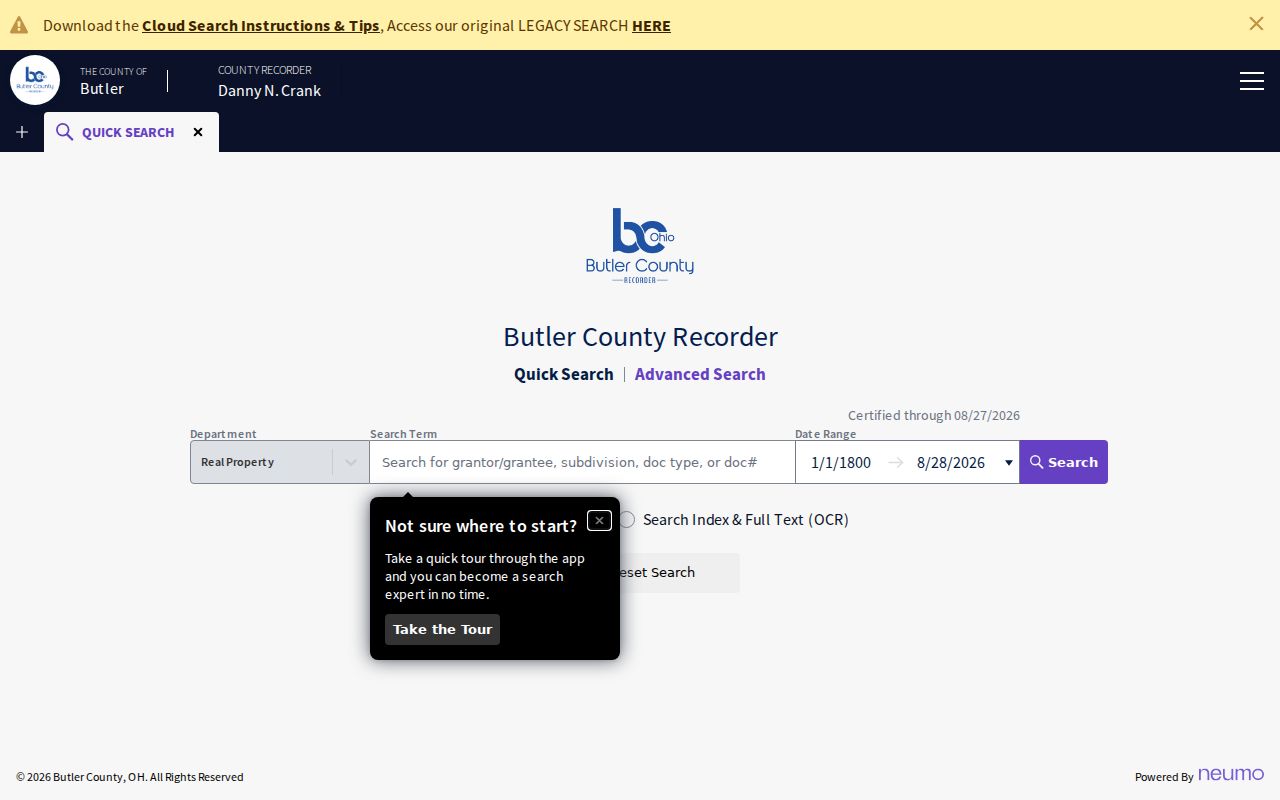
Use the displayed search controls to locate an instrument, then read the actual document and confirm the legal description. Results can be uncertified until indexing is complete, and a recording date does not establish when a household moved. The Recorder does not perform title searches, so a researcher must define the parcel and follow each record link.
Historic Indexes After Cloud Search
For an older Liberty Township address, the Recorder lists separate Geographic, Alphabetical, Historical Books, and Annexations routes. Its Red Books include selected 1803 to 1876 grantor and grantee indexes as well as a 1978 to 1987 segment, but online indexing is not exhaustive. Bring the subdivision, section-town-range, lot, book and page, or party spelling from the last proven link. That detail is more effective than a broad search for a surname or current street alone.
At the Butler County Recorder counter, a defined public record may be requested without identifying a purpose, presenting ID, or submitting a written request. A mail request needs the advance cost and a return envelope. Give the office the instrument, book and page, parcel clue, or date span already found, rather than asking staff to perform a title search.
The Butler County Records Center is the main fallback when a county portal does not reach the needed era. Its historic tax-duplicate volumes cover 1820 to 1923 and are unindexed. A request should name the Township, date range, property or owner clue, record type, contact information, and a specific question. The published rules say the first five pages are free, additional pages are 10 cents, certification is $2 per record, and email is free when possible.
No official Liberty Township Sanborn run or Township-wide renumbering project was verified. Use plats, tax duplicates, Engineer surveys and aerials, Recorder records, and local-history collections rather than filling that gap with an assumed map or renumbering date.
Plats and Tax Duplicates for Past Addresses
Before modern subdivision streets, land was often identified by larger rural tracts, sections, and owner names. The Butler County Historical Society collection includes owner-name plat maps from 1836, 1875, 1895, 1910, 1914, and 1930. It also reports county and rural directories, newspapers, family files, and local research-room material. Ask staff for the exact item, volume, and geographic scope before relying on a historical lead.
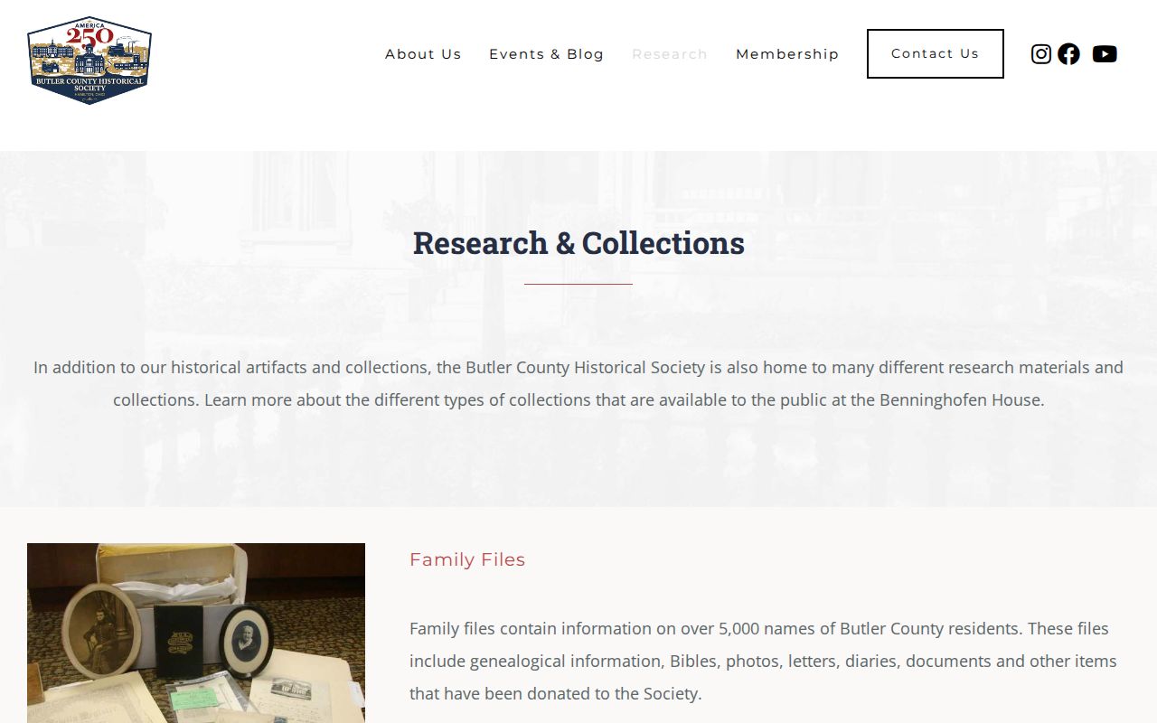
The historical-society holdings can connect a name to a tract or historic locality, while a Recorder deed and current legal description test whether it is the same property. For a split, new number, or contested boundary, Butler County Engineer keeps the address, tax-map, plat, survey, and aerial authority. A GIS display supports discovery but does not replace that determination.
Liberty Township Past Households in Directories
Ownership is only one layer. The Butler County Historical Society reports Hamilton and Middletown directories from 1858 through 2017, incomplete, plus county and rural directories. The MidPointe Digital Archives has nearby Middletown directories from 1891 through 2000, including street-address material, but it is not a complete Township roster. For an address in the nearby 45044 sphere, inspect both alphabetical and street sections, then compare the result with the parcel and date.
A printed entry can name a person or couple, a spouse pairing, occupation, a residence marker, address, and phone. It can also be stale, omitted, OCR-misread, or outside the volume's geography. The collections and how to read their entries are handled in the Liberty Township city directories; use the relevant edition as a dated household lead, not a conclusion about every person at the home.
Pairing Liberty Township Directory and Census Dates
Pair a directory entry with the closest released census and property event instead of treating the directory imprint year as a move date. Federal census schedules are released through 1950 under the 72-year rule. A household find must also be checked against its stated geography, because an old source may use Liberty, Union or West Chester Township, Hamilton, Middletown, a station name, or a rural route.
- Place the deed transfer and parcel description on a timeline, including the document and search dates.
- Choose a BCHS or MidPointe directory edition near the suspected period and retain the exact page, locality label, and abbreviation key.
- Check the nearest released census for household composition and place, then compare the Township or locality wording to the property evidence.
- Use newspapers, obituaries, probate, and historical death-index material only to corroborate a dated person or transfer, not to fill an unsupported relationship.
The 1823 formation of Union Township, now West Chester Township, from part of Liberty is a useful historical boundary clue. It is not a shortcut for assigning a particular tract. Preserve the older place name and test it against the legal description, plat, and date.
Closing a Liberty Township Property Trail
Estate and death records can explain why a property changed hands, but they should close a proven property timeline rather than start a surname theory. The Butler County Probate Court Record Search can lead to an estate, fiduciary, heir, will, guardianship, name-change, or marriage record where public access permits. A probate file may identify an executor or transaction. It does not establish a household merely because a name appears.
For historical death research, use the Ohio History Connection death index; for local context, BCHS and Lane newspaper collections are additional dated leads. The Probate Court reported temporary operations at the Government Services Center after the 2026 Historic Courthouse fire, so confirm the current counter notice before an in-person copy trip. When Recorder and Auditor details conflict, retain both citations and ask the custodian for the instrument or explanation.
Liberty Township Previous Residents, Used Lawfully
Previous residents research is most useful for house history, family history, estate questions, and a careful reconstruction of an address timeline. It should stay tied to defined records and documented dates. A deed, directory, census, obituary, permit, or parcel result may show a limited role at a particular time. It should not be stretched into a claim about a living person's location, household, or relationship.
Ohio's Public Records Act, ORC 149.43, supports requests for identifiable public records subject to required redaction. Ask the actual custodian for the specified instrument, book, page, parcel, or date span. Broad requests for everything about a person are not a substitute for a defined address-record question.